

Destination guide · Philippines
Sipalay, Negros Tauchen
Sipalay offers a quieter kind of Philippine dive holiday: coral formations, small wrecks and a beach to return to without the pace of a crowded dive hub. It is a place to enjoy a varied few days on the western Negros coast.
Sipalay, Negros im Überblick
Sipalay ist ein wenig frequentiertes Reiseziel an der Westküste von Negros mit Korallenriffen, gut zugänglichen Wracks und Tagesausflügen in Schutzgebiete wie die Insel Danjugan. Das Tauchen ist abwechslungsreich, ohne die Intensität einer abgelegenen Expedition zu erfordern.
Ruhige Strände und eine wachsende Auswahl an hochwertigeren Unterkünften machen Sipalay für Paare und kleine Gruppen geeignet, die einen anspruchsvolleren, aber dennoch entspannten Aufenthalt auf den Philippinen suchen. Die Bedingungen, der Zugang zu Wracks und die Logistik nach Danjugan sollten sorgfältig auf den ausgewählten Anbieter abgestimmt werden.
Planung Ihres Aufenthalts in Sipalay, Negros
Wählen Sie eine Unterkunft in der Nähe Ihres bevorzugten Strandes und der von dessen Tauchbasis erreichbaren Tauchplätze. An drei bis fünf Tauchtagen lassen sich Riffe mit der Außenansicht von Wracks kombinieren. Die tiefere SS Panay ist ein anderes Erlebnis als ein flaches Wracktauchen, planen Sie das Programm daher eher nach der Erfahrung als nach einer einzigen Liste von Highlights.

Sea Explorers Philippines — Sipalay
Entspannte Sea Explorers Basis am Sugar Beach mit zwölf thematisch gestalteten Takatuka-Zimmern, vier modernen Vida-Homes-Zimmern und wenig besuchten Riff- und Wracktauchplätzen.

Manami Resort
Luxuriöses Naturresort an Sipalays abgeschiedener Küste mit geräumigen Suiten und Villen sowie dem Balas Dive & Experience Center für Riffe, Wracks, Makroleben und naturnahe Auszeiten.
Wann sollte man in Sipalay, Negros tauchen?
November bis Mai ist der etablierte Planungszeitraum. Der Seegang beeinflusst sowohl den Komfort auf dem Boot als auch den Zugang zu exponierten Tauchplätzen. Ein Aufenthalt mit mehreren lokalen Riffoptionen ist flexibler als eine kurze Reise, die ausschließlich um ein tieferes Wrack oder einen Ausflug auf das Meer herum geplant ist.
Planungszeitraum: Am besten November–Mai.
Wie das Tauchen vor Ort ist
Open-Water-Taucher können viele Tauchplätze genießen; Wrackprofile erfordern entsprechende Erfahrung.
Wenig frequentierte Riffe
Sipalay verfügt über ein breites lokales Tauchplatznetzwerk mit Riffhängen, Wänden, Sandflächen und Korallengärten, die mit relativ kurzen Bootsfahrten erreichbar sind. Das Reiseziel ist weniger international frequentiert als viele zentrale Visayas-Zentren, was Tauchern entgegenkommt, die unkompliziertes Tages-Tauch-Erlebnis ohne die geschäftige Atmosphäre eines Meeresparks suchen.
Gut zugängliche Wracks
Das Gebiet umfasst sowohl flache Wracks, die für einfachere Freizeittauchprofile geeignet sind, als auch tiefere Wracks, die mehr Erfahrung erfordern. Diese Vielfalt ermöglicht es den Anbietern, Wracktauchgänge an die Zertifizierung anzupassen, anstatt jedes Wrack als Aktivität nur für Fortgeschrittene zu behandeln.
Insel Danjugan
Tagesausflüge zur Insel Danjugan ergänzen eine Sipalay-Reiseroute um geschützte Korallenhabitate, Riesenmuscheln und flache Rifflandschaften. Die Bedingungen und der Zugang zum Park werden vor Ort bestätigt, und die Insel eignet sich gut als Kontrast zum Wrack- und Küstenriff-Tauchen in der Nähe von Punta Ballo.
Entspannte Premium-Aufenthalte
Die Lage von Sipalay an der Westküste eignet sich hervorragend für Tauchurlaube in Resorts, bei denen das Tauchen mit ruhiger Strandzeit statt mit Nachtleben kombiniert wird. Es ist eine praktische Wahl für wiederholte Tauchgäste, Paare und gemischte Gruppen, die einen unkomplizierten Tagesablauf und uncrowdede Umgebung schätzen.
DIVE SITE GUIDE
Dive sites in Sipalay, Negros
Explore the character of individual sites, from the setting and marine life to the diving conditions. Open a card for the full description; site access and the final profile depend on conditions and experience.
ORIENTATION MAP
Where the dive sites are
Use the map to understand how the key sites are spread around the destination. Pins are for trip-planning orientation only; entry points, moorings and the final dive plan are always confirmed by the local operator on the day.
Coordinates are orientation references, not navigation coordinates. 'verified' means a published site coordinate; 'operator' means a clearly labelled island, locality or dive-area anchor used where the exact mooring/drop is not publicly verified. Entry points, currents and the final dive plan are always confirmed by the local operator on the day.
WWII wreck · Deep wreck
SS Panay
SS Panay is Sipalay’s headline deep wreck: a Second World War ship resting with its upper structure already around 33 metres and the deeper sections near 40 metres.
Tauchplatz entdecken
- Typ
- WWII wreck · Deep wreck
- Tiefe
- 33–40 m
- Erfahrung
- Advanced / Deep
- Strömung
- Mild–Moderate
SS Panay is Sipalay’s headline deep wreck: a Second World War ship resting with its upper structure already around 33 metres and the deeper sections near 40 metres. The depth, rather than current, is the main planning factor, so gas, no-decompression time and ascent discipline matter from the start.
The wreck is in sufficiently good condition for the ship’s form and fittings to remain visually legible, making exterior exploration rewarding without penetration. Historical artifacts should be left untouched and any overhead entry reserved for appropriately trained wreck divers. For most visitors the strongest dive is a controlled tour of the outside, followed by a slow ascent with plenty of reserve.
Look for: WWII wreck · 33–40 m · Advanced profile · Exterior exploration
Ideal für: WWII history · Wreck photography · Deep diving
Cargo wreck · Coral-covered debris
Juliens Wreck
Juliens Wreck is a broken cargo vessel spread across a broad shallow area after repeated storms.
Tauchplatz entdecken
- Typ
- Cargo wreck · Coral-covered debris
- Tiefe
- 6–20 m
- Erfahrung
- Beginner–Intermediate
- Strömung
- Mild–Moderate
Juliens Wreck is a broken cargo vessel spread across a broad shallow area after repeated storms. The wreckage begins in only a few metres of water, so divers can spend a long time moving between coral-covered sections without the time pressure of a deep wreck.
Some current can run across the upper part of the site, but the profile remains accessible to newer certified divers when conditions are suitable. Because the hull is fragmented, the appeal is less about penetration and more about the way reef life has colonised the scattered structure. It also works well for mixed groups because snorkellers can see parts of the wreck from above.
Look for: Shallow cargo wreck · Coral-covered debris · Long bottom time · Snorkel friendly
Ideal für: Easy wreck · Coral growth · Snorkel crossover
Reef · Drop-off
Toscana Reef
Toscana Reef is a compact reef close to Sipalay’s shore-based diving area, with a clear drop from roughly 15 metres toward 28 metres.
Tauchplatz entdecken
- Typ
- Reef · Drop-off
- Tiefe
- 15–28 m
- Erfahrung
- Beginner–Intermediate
- Strömung
- Mild
Toscana Reef is a compact reef close to Sipalay’s shore-based diving area, with a clear drop from roughly 15 metres toward 28 metres. The structure makes it easy to plan a multilevel profile: begin deeper along the edge, then return gradually to the shallower coral.
The site is straightforward enough for newer divers while still giving experienced photographers a defined reef face to work. Current is normally manageable, so the dive is about coral detail and relaxed observation rather than high-energy drift technique. Its moderate depth also makes Toscana a useful second dive after one of Sipalay’s deeper wrecks.
Look for: 15–28 m drop-off · Relaxed reef dive · Multilevel profile · Photography
Ideal für: Drop-off · Coral · Easy photography
Wall · Reef
Eva’s Point
Eva’s Point starts shallow and drops down a colourful wall into the low thirties, giving one site a very broad usable depth range.
Tauchplatz entdecken
- Typ
- Wall · Reef
- Tiefe
- 4–33 m
- Erfahrung
- Intermediate
- Strömung
- Mild–Moderate
Eva’s Point starts shallow and drops down a colourful wall into the low thirties, giving one site a very broad usable depth range. Divers can choose a conservative profile on the upper wall or extend deeper according to certification and gas.
The vertical structure is ideal for wide-angle photography because coral, reef fish and open water can share the same frame. A disciplined depth limit is important: it is easy to descend farther than planned when following a wall. The most efficient route takes the deeper section first and finishes in the bright upper reef.
Look for: Colourful wall · 4–33 m · Wide-angle scenery · Flexible depth
Ideal für: Colourful wall · Wide angle · Multilevel diving
Reef cracks · Canyons · Artificial reef
Grand Canyons
Grand Canyons is a shallow labyrinth of cracks and reef corridors between about 8 and 17 metres.
Tauchplatz entdecken
- Typ
- Reef cracks · Canyons · Artificial reef
- Tiefe
- 8–17 m
- Erfahrung
- Beginner–Intermediate
- Strömung
- Mild
Grand Canyons is a shallow labyrinth of cracks and reef corridors between about 8 and 17 metres. The site’s appeal is topography rather than depth: divers move through open canyon-like passages while keeping clear sight of exits and avoiding contact with the reef.
An artificial-reef feature around 15 metres adds another point of interest without changing the easy recreational profile. Because the whole dive stays shallow, bottom time is generous and the site works well for buoyancy and navigation practice. It is a good choice when a group wants structure and variety without a demanding deep dive.
Look for: 8–17 m · Reef canyons · Artificial reef · Beginner accessible
Ideal für: Canyon topography · Artificial reef · Navigation
Coral reef · Shallow slope
Turtle Island South Point
The south point of Turtle Island is a shallow coral dive where hard and soft coral fill the useful part of the profile from roughly 6 to 18 metres.
Tauchplatz entdecken
- Typ
- Coral reef · Shallow slope
- Tiefe
- 6–20 m
- Erfahrung
- Beginner
- Strömung
- Mild
The south point of Turtle Island is a shallow coral dive where hard and soft coral fill the useful part of the profile from roughly 6 to 18 metres. The modest depth gives long bottom time and plenty of natural light, making the site comfortable for newer divers and photographers.
There is no need to chase depth here; the best scenery remains on the upper reef. Mild conditions also make it a good second or third dive after deeper sites. The simple profile lets the guide spend more time on marine-life observation and less on depth management.
Look for: 6–18 m sweet spot · Hard & soft coral · Beginner friendly · Long bottom time
Ideal für: Hard & soft coral · Easy reef · Long bottom time
Reef · Sloping coral formation
Spiral Drop
Spiral Drop is named for a coral formation that winds downward from the shallows toward roughly 27 metres.
Tauchplatz entdecken
- Typ
- Reef · Sloping coral formation
- Tiefe
- 5–27 m
- Erfahrung
- Beginner–Intermediate
- Strömung
- Mild
Spiral Drop is named for a coral formation that winds downward from the shallows toward roughly 27 metres. Rather than behaving like a vertical wall, the site gives divers a continuous reef reference and an easy way to control depth.
The route naturally supports a multilevel dive: work the deeper part early, then follow the structure back upward as gas and no-decompression time decrease. Coral scenery remains productive through most of the profile, so there is little benefit in staying deep for long. The result is an accessible reef dive with enough shape to feel distinct from a simple slope.
Look for: Spiralling coral formation · 5–27 m · Easy multilevel route · Coral photography
Ideal für: Spiral reef form · Coral · Multilevel profile
Rock tower · Wall · Cavern
Cathedral Tower
Cathedral Tower is a deep rock formation whose top sits around 22 metres while the surrounding reef and wall descend much farther.
Tauchplatz entdecken
- Typ
- Rock tower · Wall · Cavern
- Tiefe
- 22–40 m
- Erfahrung
- Advanced
- Strömung
- Mild–Moderate
Cathedral Tower is a deep rock formation whose top sits around 22 metres while the surrounding reef and wall descend much farther. The combination of tower, wall and cavern-style features creates some of Sipalay’s most dramatic topography, but it also makes depth control essential.
Advanced divers can explore the exterior while maintaining a clear maximum depth and leaving overhead areas to those with suitable training. Because the shallowest part is already relatively deep, gas reserves and ascent time deserve more attention than on the nearby reefs. The site is best treated as a deep topographic dive, not a place to maximise distance.
Look for: Rock tower · Top around 22 m · Deep wall · Advanced profile
Ideal für: Deep topography · Wall · Cavern features
Unterwasserfotografie
Bei der SS Panay geben der Zweite Weltkrieg, die Wrackfotografie und das Tiefen-Tauchgang einen Eindruck von den fotografischen Möglichkeiten. Wählen Sie die Kameraausrüstung für die geplanten Tauchplätze und nehmen Sie sich dann Zeit, die Szene zu beobachten, bevor Sie das Bild aufnehmen. Die Wiederholung eines produktiven Tauchgangs bietet oft bessere Möglichkeiten als die ständige Suche nach einem anderen Ort. Verwenden Sie bei Riffszenen die Form des Riffs und das verfügbare Licht, um dem Bild Tiefe zu verleihen. Ein Taucher in respektvollem Abstand kann Maßstab bieten, ohne ein Tier einzuschüchtern.
Abseits des Tauchens: Sipalay, Negros über der Wasseroberfläche
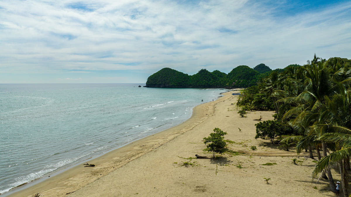
Die Strände sind ein wichtiger Bestandteil eines Aufenthalts in Sipalay, mit Zeit zum Schwimmen, für Strandspaziergänge und lange Nachmittage im Resort. Ein Naturbesuch auf Danjugan kann bei verfügbaren Besuchen Naturschutz und Insellandschaften in das Programm einbauen.
Behandeln Sie Danjugan als eine geplante Exkursion mit eigenen Zugangsregelungen. Die weitere Küste belohnt auch Reisende, die lokale Speisen und kleine Siedlungen genießen. Ein komfortabler Ausgangspunkt ist hier wichtig, weil ein Großteil des Urlaubsvergnügens in den Stunden zwischen den Ausflügen liegt.
Anreise nach Sipalay, Negros
Reisen Sie über Bacolod oder Dumaguete und fahren Sie weiter mit dem Auto nach Sipalay.
Wählen Sie Ankunfts- und Abfahrtszeiten rund um den Weitertransfer, insbesondere wenn eine Bootsüberfahrt oder eine lange Autofahrt erforderlich ist. Planen Sie einen entspannten letzten Tag an Land und ein angemessenes Zeitintervall zwischen dem letzten Tauchgang und dem Flug ein.
Fragen zum Tauchen in Sipalay, Negros
Was macht Sipalay, Negros zu einem Tauchziel?
Sipalay bietet eine ruhigere Art von philippinischem Tauchurlaub: Korallenformationen, kleine Wracks und einen Strand, an den man zurückkehren kann, ohne das Tempo eines überfüllten Tauchzentrums. Es ist ein Ort, um einige abwechslungsreiche Tage an der Westküste von Negros zu genießen.
Wie sollte ich meinen Aufenthalt planen?
Wählen Sie eine Unterkunft in der Nähe Ihres bevorzugten Strandes und der von dessen Tauchbasis erreichbaren Tauchplätze. An drei bis fünf Tauchtagen lassen sich Riffe mit der Außenansicht von Wracks kombinieren. Die tiefere SS Panay ist ein anderes Erlebnis als ein flaches Wracktauchen, planen Sie das Programm daher eher nach der Erfahrung als nach einer einzigen Liste von Highlights.
Wann ist eine gute Reisezeit?
November bis Mai ist der etablierte Planungszeitraum. Der Seegang beeinflusst sowohl den Komfort auf dem Boot als auch den Zugang zu exponierten Tauchplätzen. Ein Aufenthalt mit mehreren lokalen Riffoptionen ist flexibler als eine kurze Reise, die ausschließlich um ein tieferes Wrack oder einen Ausflug auf das Meer herum geplant ist.
Gibt es genug für Nicht-Taucher?
Die Strände sind ein wichtiger Bestandteil eines Aufenthalts in Sipalay, mit Zeit zum Schwimmen, für Strandspaziergänge und lange Nachmittage im Resort. Ein Naturbesuch auf Danjugan kann bei verfügbaren Besuchen Naturschutz und Insellandschaften in das Programm einbauen.
A closer look at Sipalay, Negros
Planen Sie Ihre Reise nach Sipalay, Negros
Erzählen Sie uns, welche Erlebnisse Sie sich am meisten wünschen, Ihre bevorzugten Daten und wie Sie reisen möchten. Wir können das Reiseziel, die Unterkunft und das Tauchen in einen kohärenten Reiseplan zusammenfassen.
Meine Reise planenFoto-Credits
Die Bilder werden für die Anzeige skaliert und können zugeschnitten werden, um in das Seitenlayout zu passen.
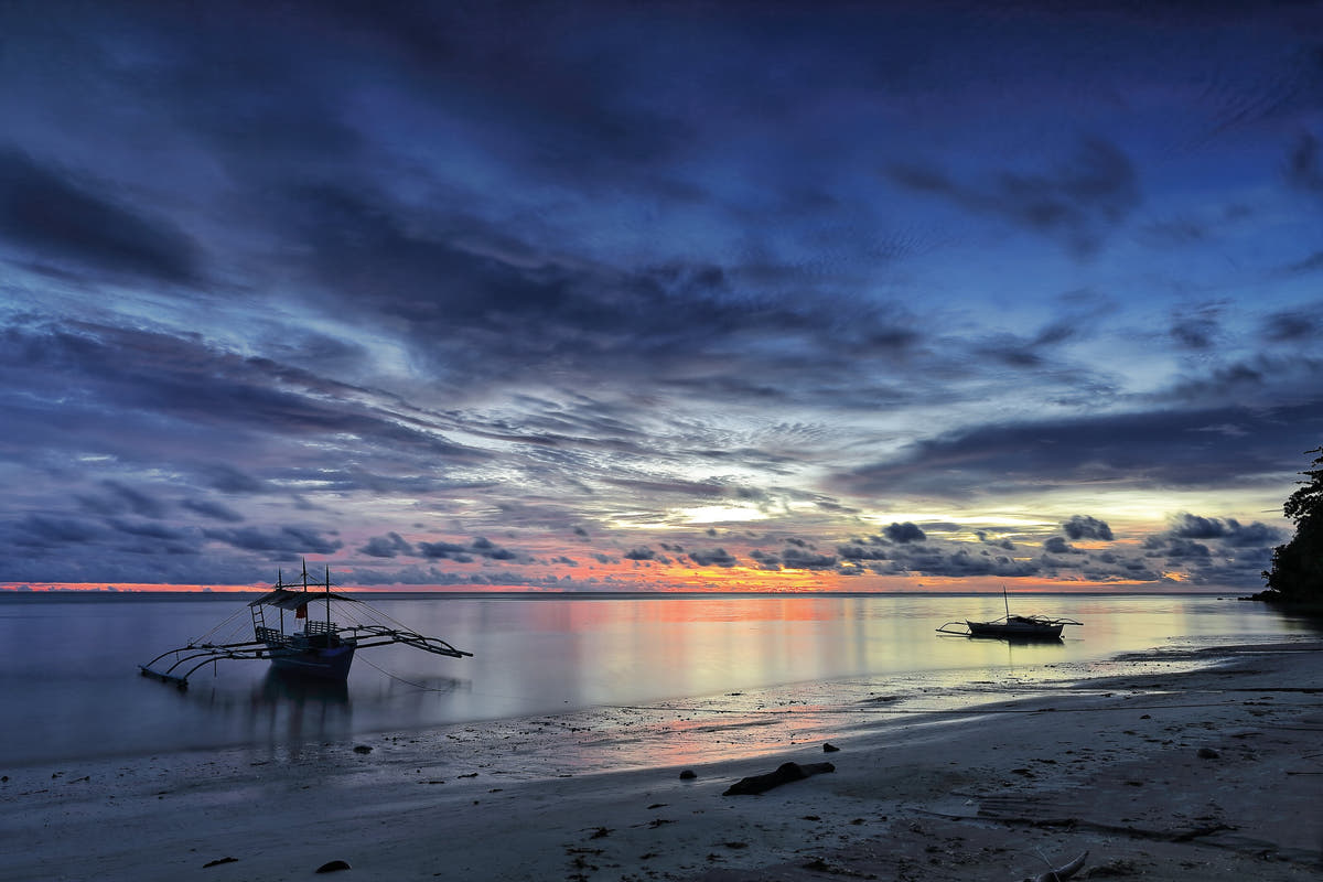
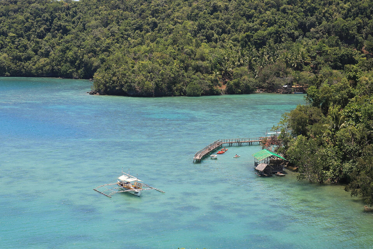
- Outrigger-Boot in einer türkisfarbenen Bucht entlang der Küste von Sipalay, Negros: Pump boat in Sipalay.jpg — TheTallTexan. CC BY-SA 4.0. Webgrößenbild bereitgestellt von Wikimedia Commons; keine Bildbearbeitung.
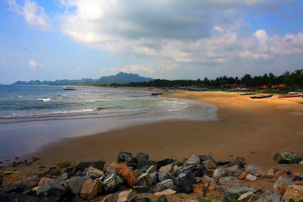
- Strand und Küstenhügel in Sipalay, Negros Occidental: Sipalay Beach (Negros Occidental, Philippines).jpg — Paolobon140. CC BY-SA 4.0. Webgrößenbild bereitgestellt von Wikimedia Commons; keine Bildbearbeitung.
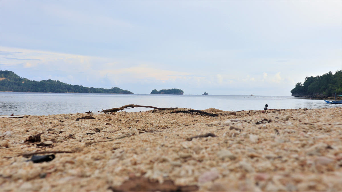
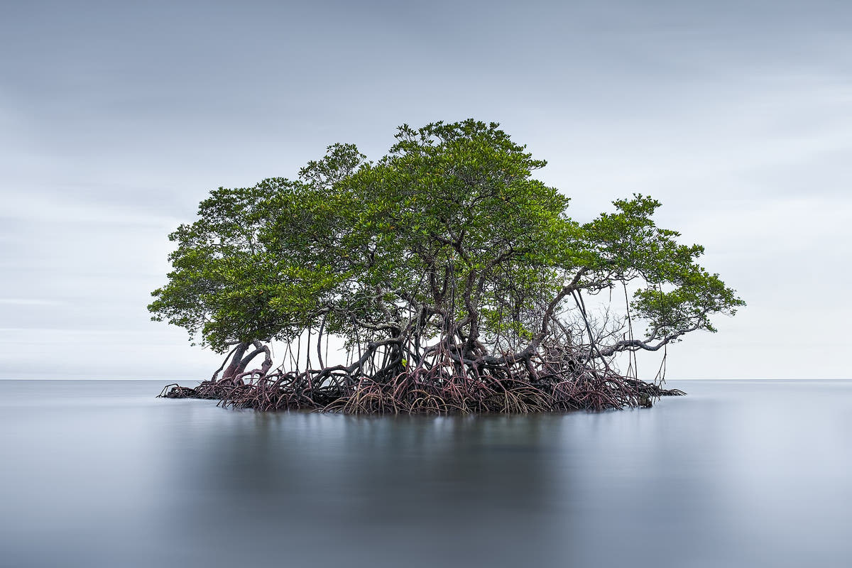
- Kleine Mangroveninsel vor der Küste von Sipalay, Negros: Mangrove Islet.jpg — Armusaofficial. CC BY-SA 4.0. Webgrößenbild bereitgestellt von Wikimedia Commons; keine Bildbearbeitung.


