

Destination guide · Solomon Islands
Gizo Buceo
Gizo combines the scale of a large wreck with reefs that come alive in moving water. Aircraft remains, island scenery and small local communities give a Western Province journey more than one story to follow.
Gizo de un vistazo
Gizo en la provincia occidental de Solomon Islands combina la acción de arrecifes en alta mar con una de las concentraciones más fuertes de la región de la historia de buceo accesible de la Segunda Guerra Mundial. Los arrecifes y pináculos alimentados actualmente se encuentran junto a grandes naufragios y restos de aeronaves, lo que le da a una estadía en tierra más variedad que un programa puramente centrado en los arrecifes.
El destino se aborda mejor con flexibilidad. Sitios como Grand Central Station y The Gap dependen del movimiento del agua para su acción escolar de peces y depredadores, mientras que las inmersiones en naufragios deben coincidir con la profundidad, la certificación y el entrenamiento de penetración. Los arrecifes más fáciles y las excursiones por las islas equilibran los días más avanzados.
Planificar su estancia en Gizo
Elija Gizo o una base de la isla de acuerdo con el entorno y el programa diario del barco que prefiera. De cinco a siete noches permite que arrecifes, naufragios e intereses terrestres compartan el viaje. Los sitios de Toa Maru y los aviones tienen diferentes perfiles, así que selecciónalos individualmente en lugar de como una categoría de buceo en naufragios.
Liveaboard routes for this destination
Explore the routes that visit this region. Compare ships and itineraries, then open a route to see its sailing dates, cabins and the areas it covers.
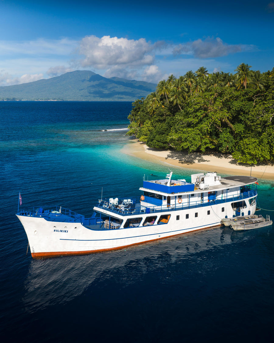
Emperor Bilikiki
Lo mejor de Solomon Islands
- Indicative duration
- 10 nights
- Embarque
- Honiara
- Desembarque
- Honiara
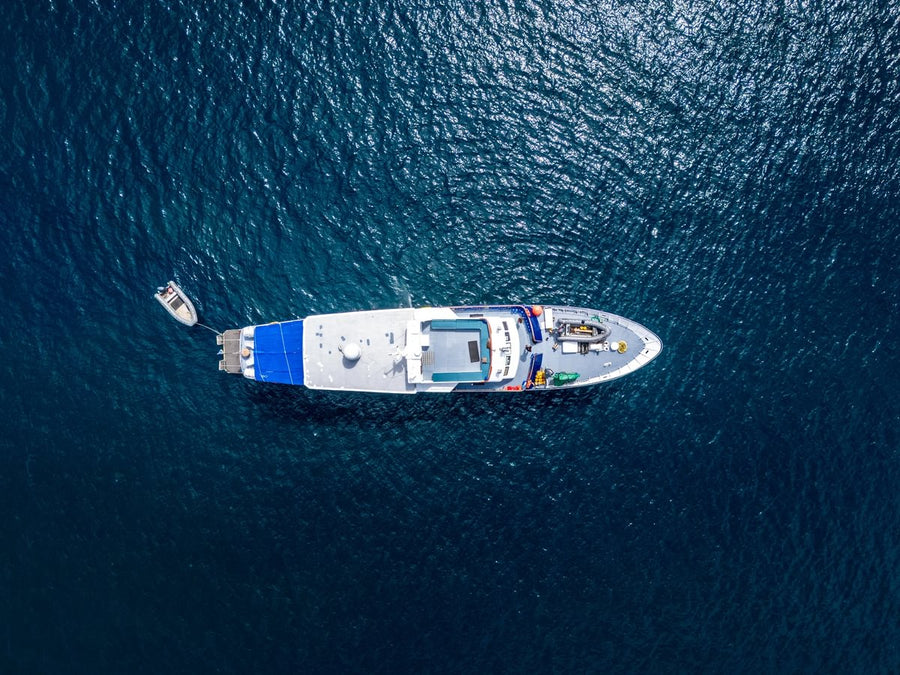
Solomons Master
Best of the Solomons — 10 noches
- Indicative duration
- 10 nights
- Embarque
- Honiara
- Desembarque
- Honiara
Solomons Master
Guadalcanal & Western Province — 10 noches
- Indicative duration
- 10 nights
- Embarque
- Honiara / route-dependent
- Desembarque
- Munda / Honiara route-dependent
No routes match this search. Try another vessel or clear your search.
Cuándo bucear Gizo
El buceo funciona durante todo el año, y de abril a noviembre es un período de inicio útil para la planificación. Los sitios alimentados actualmente y la visibilidad de los naufragios pueden variar sustancialmente. Deje flexibilidad en el orden del sitio y suficiente tiempo en los viajes nacionales para proteger los días de buceo.
Ventana de planificación: Mejor abril-noviembre.
Cómo es el buceo
Advanced Open Water se prefiere para los sitios actuales de la firma; perfiles de naufragios más profundos requieren la experiencia y las calificaciones adecuadas.
Estación Grand Central
Este arrecife marino es conocido por la agregación de peces cuando el agua oceánica se mueve a través del sitio. Trevally, barracuda, tiburones de arrecife y bancos de peces densos son posibles, pero la intensidad depende de la marea y la corriente.
El Gap y el buceo actual
The Gap agrega un perfil clásico dirigido por la corriente donde los buceadores pueden moverse con agua a lo largo de la estructura del arrecife mientras observan a los peces y depredadores. Un buen control de grupo y ascensos seguros en aguas abiertas son importantes.
Toa Maru y los naufragios de la Segunda Guerra Mundial
El Toa Maru y otros restos de guerra le dan a Gizo una profundidad histórica excepcional. La profundidad del naufragio, la penetración y los límites de gas siempre deben coincidir con el buzo individual en lugar de venderse como una inclusión estándar.
Variedad basada en islas
El corto acceso en barco a arrecifes, naufragios y pequeñas islas hace que Gizo sea práctico para itinerarios mixtos. Los intervalos de superficie pueden incluir playas, pueblos o paradas históricas de la Segunda Guerra Mundial en lugar de regresar a una plataforma de buceo fija.
DIVE SITE GUIDE
Dive sites in Gizo
Explore the character of individual sites, from the setting and marine life to the diving conditions. Open a card for the full description; site access and the final profile depend on conditions and experience.
ORIENTATION MAP
Where the dive sites are
Use the map to understand how the key sites are spread around the destination. Pins are for trip-planning orientation only; entry points, moorings and the final dive plan are always confirmed by the local operator on the day.
Coordinates are planning references compiled from current dive-site sources. They are not navigation coordinates; entry points, moorings, tide windows and the final dive plan are always confirmed by the local operator on the day.
WWII shipwreck · Reef
Toa Maru
Toa Maru is Gizo’s defining wreck: a Japanese transport ship roughly 140 metres long resting on its starboard side in a sheltered bay.
Explorar este punto de buceo
- Tipo
- WWII shipwreck · Reef
- Profundidad
- 15–35 m
- Experiencia
- Advanced
- Corriente
- Mild
Toa Maru is Gizo’s defining wreck: a Japanese transport ship roughly 140 metres long resting on its starboard side in a sheltered bay. Parts of the wreck lie within recreational depth, while deeper sections and internal spaces require more advanced planning.
Trucks, fuel drums, ammunition and other wartime cargo remain part of the historical story, but divers should avoid disturbing artifacts and should only penetrate within wreck training. Coral and marine life have transformed the ship into an artificial reef, giving the dive biological as well as historical value. Because the wreck is large, a single dive is best treated as one planned section rather than an attempt to see everything.
Look for: ~140 m shipwreck · WWII artifacts · 15–35 m · Major Gizo wreck
Ideal para: Large wreck · WWII artifacts · Photography
Wall · Point · Current
Grand Central Station
Grand Central Station sits at the northwest tip of the Gizo area where currents concentrate fish around a reef wall and point.
Explorar este punto de buceo
- Tipo
- Wall · Point · Current
- Profundidad
- 5–28 m
- Experiencia
- Intermediate–Advanced
- Corriente
- Moderate
Grand Central Station sits at the northwest tip of the Gizo area where currents concentrate fish around a reef wall and point. The site is famous for the sheer amount of marine traffic: schools of fish stream past the reef while sharks, trevally and other larger animals can use the current line.
The dive starts shallow, moves along the wall and becomes more energetic near the point. The exact current determines whether the group pauses or continues as a drift. Public sources describe the location clearly near Njari Island, but do not publish one consistent mooring coordinate, so the map uses an area anchor rather than false precision.
Look for: High fish biomass · Current-fed point · Sharks possible · Signature reef dive
Ideal para: Fish biomass · Sharks · Trevally · Wide angle
Wall · Gorgonians · Macro
Joe’s Wall
Joe’s Wall is a reef slope that steepens into a wall and then returns toward gentler terrain, giving the dive a natural beginning and end without requiring a deep profile.
Explorar este punto de buceo
- Tipo
- Wall · Gorgonians · Macro
- Profundidad
- 5–27 m
- Experiencia
- Intermediate
- Corriente
- Mild–Moderate
Joe’s Wall is a reef slope that steepens into a wall and then returns toward gentler terrain, giving the dive a natural beginning and end without requiring a deep profile. Large gorgonian fans are the visual highlight, while smaller reef animals and invertebrates make the site strong for macro photography.
The wall is less fish-dense than Grand Central Station, which is precisely why divers can focus on detail rather than open-water action. The exact public GPS is not consistently published, so the map uses an operator-area anchor near Ferguson Passage.
Look for: Gorgonian wall · Macro · Moderate depth · Photography
Ideal para: Sea fans · Macro · Wall photography
Reef point · Pelagic
Hot Spot
Hot Spot is one of Gizo’s higher-energy reef dives, where current across the point can bring sharks, trevally and barracuda into the blue.
Explorar este punto de buceo
- Tipo
- Reef point · Pelagic
- Profundidad
- 8–30 m
- Experiencia
- Advanced
- Corriente
- Moderate–Strong
Hot Spot is one of Gizo’s higher-energy reef dives, where current across the point can bring sharks, trevally and barracuda into the blue. The site is best for divers comfortable holding position near a reef edge and then moving with the flow rather than swimming against it.
The reef itself remains healthy and worth attention when the pelagics stay farther away. Exact dive timing depends on tide, and the public site coordinate is not standardized, so the map uses an operator-area position. The strongest dive is a controlled current profile rather than a chase after individual animals.
Look for: Pelagic action · Sharks possible · Current point · Advanced profile
Ideal para: Sharks · Trevally · Barracuda · Current
Reef slope · Wall · Coral
Secret Spot
Secret Spot is a reef-focused Gizo dive where coral cover and fish life take priority over wreck history.
Explorar este punto de buceo
- Tipo
- Reef slope · Wall · Coral
- Profundidad
- 5–30 m
- Experiencia
- Intermediate
- Corriente
- Mild–Moderate
Secret Spot is a reef-focused Gizo dive where coral cover and fish life take priority over wreck history. A sloping reef steepens toward a wall and gives divers several depth bands to work through during one profile.
The site suits photographers because there is enough structure for wide-angle compositions without the constant movement of a strong current site. Smaller subjects remain available close to the reef, so the dive can switch naturally between broad scenery and detail. The exact public mooring is not published consistently, so the map point is an operator-area reference.
Look for: Coral reef · Wall transition · Photography · Moderate current
Ideal para: Coral · Reef fish · Wide-angle photography
Aircraft wreck · Shallow lagoon
Grumman F6F Hellcat
The Grumman Hellcat is one of the easiest WWII aircraft dives in the Solomon Islands.
Explorar este punto de buceo
- Tipo
- Aircraft wreck · Shallow lagoon
- Profundidad
- 9–10 m
- Experiencia
- Beginner
- Corriente
- Mild–None
The Grumman Hellcat is one of the easiest WWII aircraft dives in the Solomon Islands. The fighter rests upright in a shallow lagoon at only about 9–10 metres, with excellent visibility and little current.
Its recognizable shape, including cockpit and airframe, makes it a rewarding historical dive without requiring deep certification or wreck penetration. Coral growth and schooling fish have turned the aircraft into a small artificial reef. The shallow profile gives long bottom time and makes the site suitable for newer divers and even snorkellers viewing from above.
Look for: F6F Hellcat · 9–10 m · Beginner friendly · WWII history
Ideal para: WWII aircraft · Snorkel crossover · Photography
Aircraft wreck · Reef
American Corsair Fighter
Gizo’s American Corsair wreck adds another layer to the area’s extraordinary concentration of Pacific War history.
Explorar este punto de buceo
- Tipo
- Aircraft wreck · Reef
- Profundidad
- 15–30 m
- Experiencia
- Intermediate–Advanced
- Corriente
- Mild
Gizo’s American Corsair wreck adds another layer to the area’s extraordinary concentration of Pacific War history. The fighter rests in recreational depth and can be explored externally without any overhead complexity.
Its compact size makes it easy to circle, photograph and appreciate as an aircraft rather than a debris field. The surrounding reef and fish life keep the dive visually active after the wreck itself has been covered. Public exact GPS is not consistently published, so the map uses an operator-area anchor in the wider Gizo aircraft-wreck zone.
Look for: Corsair fighter · WWII history · Recreational depth · Photography
Ideal para: WWII aircraft · Photography · Historical dive
Shallow reef · Historical island
Kennedy / Plum Pudding Island Reef
Kennedy Island, also known as Plum Pudding Island, combines an easy coral dive with one of Gizo’s best-known WWII stories.
Explorar este punto de buceo
- Tipo
- Shallow reef · Historical island
- Profundidad
- 5–18 m
- Experiencia
- Beginner
- Corriente
- Mild
Kennedy Island, also known as Plum Pudding Island, combines an easy coral dive with one of Gizo’s best-known WWII stories. Lieutenant John F. Kennedy and surviving crew reached the island after PT-109 was sunk nearby in 1943.
Underwater, the reef slopes gently through roughly 5–18 metres and supports coral, nudibranchs, anemonefish and other reef life. The site is ideal for mixed groups because it is shallow, calm and visually rewarding without technical demands. It works especially well as a second dive paired with a deeper wreck or reef point.
Look for: JFK / PT-109 history · 5–18 m · Beginner friendly · Coral garden
Ideal para: Coral garden · History · Easy reef
Fotografía submarina
En Toa Maru, naufragios grandes, artefactos de la Segunda Guerra Mundial, la fotografía da una idea de las posibilidades fotográficas. Elija la configuración de la cámara para los sitios planificados, luego deje tiempo para observar la escena antes de hacer la imagen. Repetir una inmersión productiva a menudo crea mejores oportunidades que buscar constantemente una ubicación diferente. Para las escenas de arrecife, use la forma del arrecife y la luz disponible para dar profundidad a la imagen. Un buceador a una distancia respetuosa puede proporcionar escala sin hacinarse con un animal.
Más allá del buceo: Gizo sobre la superficie
El salto de islas, los mercados locales y la historia de la Segunda Guerra Mundial agregan variedad más allá del buceo. Las excursiones a la laguna y el snorkel pueden ser compartidos por un grupo mixto, con el tiempo en tierra revelando más del entorno que una rutina de barco a resort solo.
La llegada a Nusatupe ya hace que el agua forme parte del viaje. Mantenga el traslado en barco y las conexiones domésticas realistas, y deje que la isla se quede con suficiente tiempo para una tarde no planificada, así como las excursiones principales.
Llegar a Gizo
Vuele a Honiara (HIR), conéctese en un vuelo nacional a Gizo / Nusatupe (GZO) y continúe con un corto traslado en barco a Gizo o al complejo isleño seleccionado. Dejar tiempo de búfer alrededor de las conexiones domésticas.
Elija los horarios de llegada y salida alrededor del traslado, especialmente cuando se trata de un cruce en barco o un largo viaje por carretera. Deje espacio para un relajado día final en tierra y un intervalo apropiado entre la última inmersión y el vuelo.
Preguntas de buceo Gizo
¿Qué hace que Gizo valga la pena un viaje de buceo?
Gizo combina la escala de un gran naufragio con arrecifes que cobran vida en el agua en movimiento. Los restos de aviones, el paisaje de la isla y las pequeñas comunidades locales le dan a un viaje por la provincia occidental más de una historia a seguir.
¿Cómo debo planificar mi estancia?
Elija Gizo o una base de la isla de acuerdo con el entorno y el programa diario del barco que prefiera. De cinco a siete noches permite que arrecifes, naufragios e intereses terrestres compartan el viaje. Los sitios de Toa Maru y los aviones tienen diferentes perfiles, así que selecciónalos individualmente en lugar de como una categoría de buceo en naufragios.
¿Cuándo es un momento útil para visitar?
El buceo funciona durante todo el año, y de abril a noviembre es un período de inicio útil para la planificación. Los sitios alimentados actualmente y la visibilidad de los naufragios pueden variar sustancialmente. Deje flexibilidad en el orden del sitio y suficiente tiempo en los viajes nacionales para proteger los días de buceo.
¿Hay suficiente para los compañeros que no bucean?
El salto de islas, los mercados locales y la historia de la Segunda Guerra Mundial agregan variedad más allá del buceo. Las excursiones a la laguna y el snorkel pueden ser compartidos por un grupo mixto, con el tiempo en tierra revelando más del entorno que una rutina de barco a resort solo.
A closer look at Gizo


Planifica tu viaje a Gizo
Cuéntanos las experiencias que más te gusten, tus fechas preferidas y cómo te gusta viajar. Podemos traer el destino, alojamiento y buceo en un itinerario coherente.
Planificar mi viajeCréditos fotográficos
Las imágenes se redimensionan para su visualización y pueden recortarse para adaptarse al diseño de la página.
- Puesta del sol sobre una cala en el extremo occidental de la isla de Gizo, Solomon Islands: Private Cove (131402091).jpeg — Sahid Martin Robles Bello. CC BY-SA 3.0. Imagen de tamaño web suministrada por Wikimedia Commons; ninguna edición de escena.
- Calle y edificios locales en Gizo, Solomon Islands: Ghizo-Island, Salomonen.jpg — Seelore. CC BY-SA 3.0. Imagen de tamaño web suministrada por Wikimedia Commons; ninguna edición de escena.

