

Destination guide · Indonesia
Morotai Island Diving
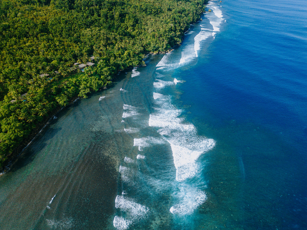
Morotai brings reef diving and wartime history together on a remote North Maluku island. Sharks, submerged structures and coral scenery share the trip with empty-looking coastlines, green inland landscapes and island-hopping days.
Morotai Island at a glance
Morotai brings reef diving and wartime history together on a remote North Maluku island. Sharks, submerged structures and coral scenery share the trip with empty-looking coastlines, green inland landscapes and island-hopping days.
Planning your Morotai Island stay
Choose a base that can balance reef and wreck interests with land excursions. Six to eight nights is a useful starting point for a remote destination, allowing both travel buffers and days when the sea decides the order of activities.

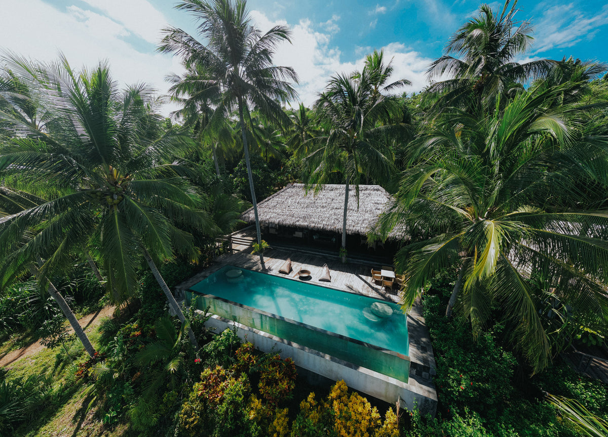
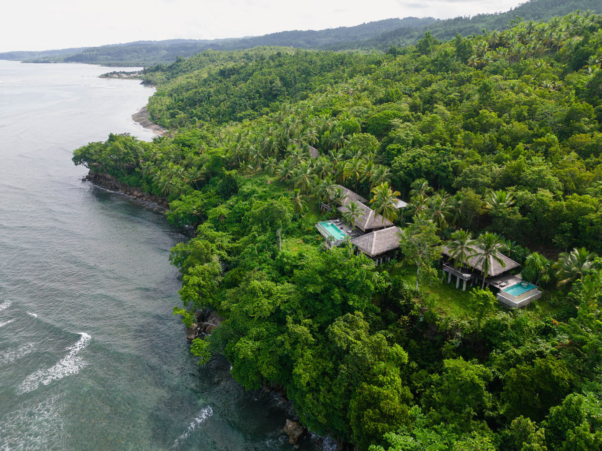
Moro Ma Doto Resort & Spa
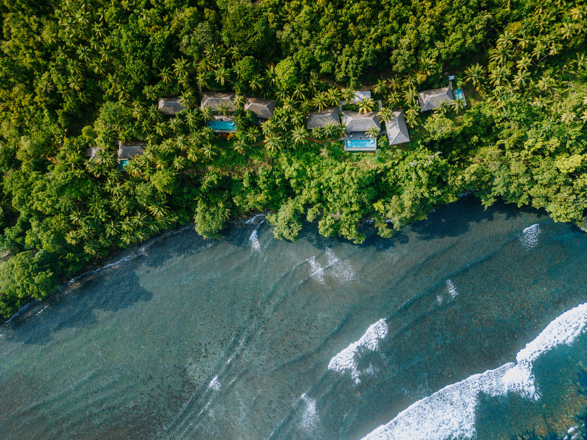
Boutique full-board island resort on remote Morotai, combining private villas and suites with access to uncrowded reefs, WWII underwater history, surfing, fishing, island exploration and Jungle Rock Spa.
When to dive Morotai Island
Diving is possible across the year. May to October is the existing calmer-season planning window, with July to September useful when wreck access is a priority. Remote connections and exposed sites make flexibility particularly valuable.
Planning window: Often calmer May–October.
What the diving is like
Choose the islands and sites to suit the group’s experience.
The character of the diving
Morotai brings reef diving and wartime history together on a remote North Maluku island. Sharks, submerged structures and coral scenery share the trip with empty-looking coastlines, green inland landscapes and island-hopping days.
DIVE SITE GUIDE
Dive sites in Morotai Island
Explore the character of individual sites, from the setting and marine life to the diving conditions. Open a card for the full description; site access and the final profile depend on conditions and experience.
ORIENTATION MAP
Where the dive sites are
Use the map to understand how the key sites are spread around the destination. Pins are for trip-planning orientation only; entry points, moorings and the final dive plan are always confirmed by the local operator on the day.
Coordinates are orientation references, not navigation coordinates. 'verified' means a published site coordinate; 'operator' means a clearly labelled island, locality or dive-area anchor used where the exact mooring/drop is not publicly verified. Entry points, currents and the final dive plan are always confirmed by the local operator on the day.
Shark point · Sandy slope · Reef
Mitita Shark Point
Mitita Shark Point is Morotai’s best-known shark dive, centred on a sandy reef area where blacktip reef sharks regularly move through the water column.
Explore this dive site
- Type
- Shark point · Sandy slope · Reef
- Depth
- 10–22 m
- Experience
- Intermediate
- Current
- Moderate
Mitita Shark Point is Morotai’s best-known shark dive, centred on a sandy reef area where blacktip reef sharks regularly move through the water column. Public reports place the main viewing depth around 17–18 metres, keeping the dive well inside normal recreational limits.
The correct approach is to settle calmly, remain close to the guide and let sharks choose their distance rather than swimming after them. Current can help concentrate activity, so timing matters more than covering ground. The map point uses Metita Island as the local anchor because the exact operational drop changes with conditions.
Look for: Blacktip reef sharks · ~18 m viewing depth · Shark etiquette · Morotai signature
Best for: Blacktip reef sharks · Shark observation · Clear water
WWII vehicles & aircraft · Deep heritage site
Wawama Wreck
Wawama is not one single intact ship but an underwater heritage area containing Second World War vehicles and aircraft remains.
Explore this dive site
- Type
- WWII vehicles & aircraft · Deep heritage site
- Depth
- 12–50 m
- Experience
- Advanced / Deep
- Current
- Mild–Moderate
Wawama is not one single intact ship but an underwater heritage area containing Second World War vehicles and aircraft remains. Jeep and vehicle components can be encountered around the mid-twenties, while some aircraft material lies much deeper, into the 40–50 metre range.
That means the guide can select a profile appropriate to certification rather than treating every visit as the same dive. The historical objects should be observed in place and never moved or collected. Because the deeper material pushes beyond ordinary recreational comfort, a conservative plan around the shallower remains is often the better choice.
Look for: WWII vehicles · Aircraft remains · 25 m jeep area · Deep sections to 40–50 m
Best for: WWII vehicles · Aircraft remains · Underwater heritage
Scuttled fishing vessel · Artificial reef
Susi Wreck
Susi Wreck is a confiscated fishing vessel deliberately sunk in 2019 and now used as one of Morotai’s more accessible wreck dives.
Explore this dive site
- Type
- Scuttled fishing vessel · Artificial reef
- Depth
- 18–30 m
- Experience
- Intermediate
- Current
- Mild
Susi Wreck is a confiscated fishing vessel deliberately sunk in 2019 and now used as one of Morotai’s more accessible wreck dives. Unlike the deep WWII aircraft, it sits within normal recreational depth, with published visitor reports describing the wreck around the 20–30 metre band.
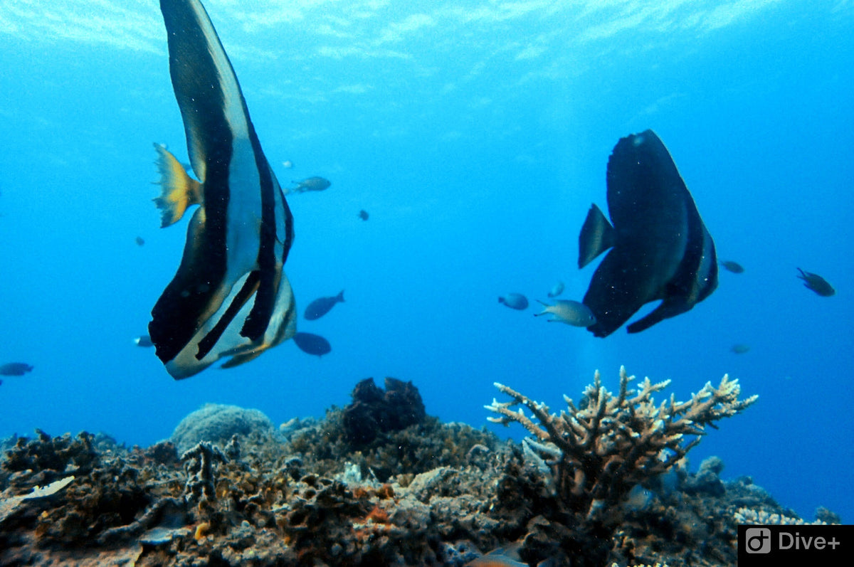
Grouper, barracuda and smaller reef fish use the structure, while open exterior lines make it possible to enjoy the wreck without penetration. The site works well as a bridge between reef diving and Morotai’s more serious historical wreck profiles. The map uses the southern Morotai dive area as an operator anchor because a reliable public wreck GPS is not available.
Look for: Scuttled in 2019 · Recreational-depth wreck · Grouper & barracuda · Exterior exploration
Best for: Accessible wreck · Grouper · Barracuda · Photography
Cave entrance · Wall · Reef
Galo Galo Cave
Galo Galo Cave adds a topographic dive to a Morotai itinerary otherwise dominated by reefs, sharks and wartime history.
Explore this dive site
- Type
- Cave entrance · Wall · Reef
- Depth
- 6–30 m
- Experience
- Intermediate–Advanced
- Current
- Mild–Moderate
Galo Galo Cave adds a topographic dive to a Morotai itinerary otherwise dominated by reefs, sharks and wartime history. Local dive programmes specifically include the site, and regional descriptions note a shallow cave feature that leads out toward deeper wall terrain.
Divers should keep the distinction between an open cavern and a true overhead environment clear: nobody needs to penetrate beyond training to enjoy the site. The outside reef remains productive and may bring larger passing animals. The map point is anchored to Galo-Galo village/island because the exact cave entrance is not published.
Look for: Cave feature · Wall outside · 6–30 m profile · Operator-guided route
Best for: Cave entrance · Mobula chance · Wall diving
Island reef · Coral slope
Dodola Point
Dodola Point is the reef-diving side of a Morotai trip, using the clear water and coral around the Dodola islands rather than a wreck or shark aggregation.
Explore this dive site
- Type
- Island reef · Coral slope
- Depth
- 5–25 m
- Experience
- Beginner–Intermediate
- Current
- Mild–Moderate
Dodola Point is the reef-diving side of a Morotai trip, using the clear water and coral around the Dodola islands rather than a wreck or shark aggregation. The profile can be kept shallow for newer divers, while intermediate groups extend along the slope according to current.
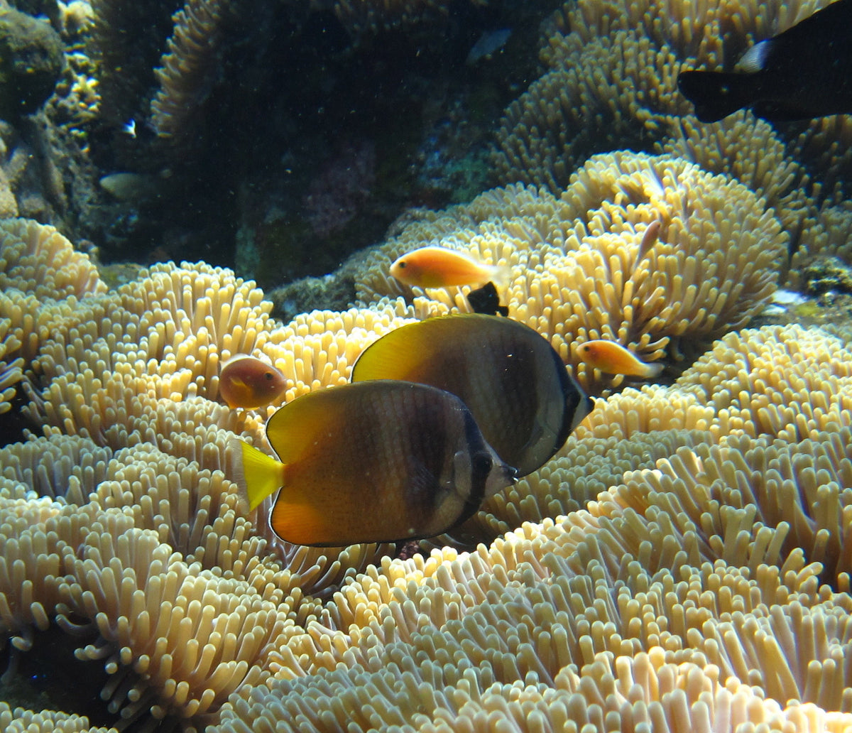
It is most useful as a relaxed counterpoint to the deeper historical sites. Reef fish and coral detail are the main attraction, and the sandy island setting gives strong natural light in the upper metres. The map marks Dodola Island itself; the daily entry is selected by the operator.
Look for: Island reef · Mixed-experience dive · Coral slope · Relaxed profile
Best for: Coral reef · Clear water · Mixed experience groups
Island point · Reef
Kokoya Point
Kokoya Point is one of the named southern Morotai sites used by local dive programmes.
Explore this dive site
- Type
- Island point · Reef
- Depth
- 5–25 m
- Experience
- Intermediate
- Current
- Moderate
Kokoya Point is one of the named southern Morotai sites used by local dive programmes. The island position exposes the reef to more water movement than a sheltered bay, so the guide chooses the side and direction according to tide.
Coral and schooling reef fish make it a strong wide-angle dive even when no large animal passes. The depth can remain comfortably recreational, but current management matters more than the numbers suggest. The map uses the published Kokoya Island position rather than claiming an exact mooring.
Look for: Island point · Current-fed reef · Schooling fish · Wide-angle diving
Best for: Reef fish · Current point · Wide angle
Fringing reef · Coral
Kolorai Reef
Kolorai Reef offers straightforward fringing-reef diving in the island group west of southern Morotai.
Explore this dive site
- Type
- Fringing reef · Coral
- Depth
- 3–25 m
- Experience
- Beginner–Intermediate
- Current
- Mild
Kolorai Reef offers straightforward fringing-reef diving in the island group west of southern Morotai. It is a useful site for a check dive or a lower-intensity day because the profile begins shallow and can be adjusted easily for mixed experience levels.
The reef is best approached slowly, with time spent on coral condition, small reef fish and photographic details rather than chasing depth. Water movement can increase away from the island, so the guide keeps the route on the protected side when needed. The coordinate is an island/locality anchor, not a surveyed descent point.
Look for: Fringing reef · Beginner accessible · Shallow finish · Island photography
Best for: Coral reef · Easy profile · Photography
Point · Reef · Shark potential
Tosininga Point
Tosininga Point appears repeatedly in local Morotai dive itineraries and is known as a reef point where larger reef animals may mix with the normal coral fish community.
Explore this dive site
- Type
- Point · Reef · Shark potential
- Depth
- 5–25 m
- Experience
- Intermediate
- Current
- Moderate
Tosininga Point appears repeatedly in local Morotai dive itineraries and is known as a reef point where larger reef animals may mix with the normal coral fish community. Reports include blacktip and whitetip reef sharks, turtles, octopus and Napoleon wrasse, though none should be treated as guaranteed sightings.
The point layout means current and entry direction can change the character of the dive from relaxed reef tour to controlled drift. A moderate depth band keeps the profile simple while the group follows the guide’s tide plan. With no dependable public site GPS, the map uses the south-Morotai dive-area reference and labels it accordingly.
Look for: Reef point · Sharks possible · Turtles & wrasse · Current-aware plan
Best for: Reef sharks · Turtles · Napoleon wrasse · Reef fish
Underwater photography
At Mitita Shark Point, blacktip reef sharks, Shark observation, Clear water give an idea of the photographic possibilities. Choose the camera setup for the planned sites, then leave time to observe the scene before making the image. Repeating a productive dive often creates better opportunities than constantly searching for a different location. For reef scenes, use the shape of the reef and the available light to give the image depth. A diver at a respectful distance can provide scale without crowding an animal.
Beyond diving: Morotai Island above the surface
Dodola and the surrounding islands make the sea journey part of the holiday, with beaches, sandbars and snorkelling stops. Inland outings can include waterfalls and forest scenery, while local villages and WWII heritage give Morotai a story beyond its reefs.
The existing island programme includes Nakamura and Kokota waterfalls and visits around the coast. Leave room for the distances and the weather. A well-paced dry day is more rewarding than trying to combine every attraction with two or three dives.
Getting to Morotai Island
Morotai's local gateway is Pitu / Leo Wattimena Airport (OTI). Most international itineraries connect through a major Indonesian hub and then Ternate (TTE) before continuing to Morotai.
Domestic flight schedules to Morotai are limited and can change. A road-and-boat route via Sofifi and Tobelo is an alternative when required. We therefore build Morotai itineraries with connection margins and reconfirm every domestic sector close to booking and travel.
Your final resort transfer from Morotai airport or harbour is arranged according to arrival details. Allow appropriate no-fly time after your final dive before any onward flight.
Morotai Island diving questions
What makes Morotai Island worth a diving trip?
Morotai brings reef diving and wartime history together on a remote North Maluku island. Sharks, submerged structures and coral scenery share the trip with empty-looking coastlines, green inland landscapes and island-hopping days.
How should I plan my stay?
Choose a base that can balance reef and wreck interests with land excursions. Six to eight nights is a useful starting point for a remote destination, allowing both travel buffers and days when the sea decides the order of activities.
When is a useful time to visit?
Diving is possible across the year. May to October is the existing calmer-season planning window, with July to September useful when wreck access is a priority. Remote connections and exposed sites make flexibility particularly valuable.
Is there enough for non-diving companions?
Dodola and the surrounding islands make the sea journey part of the holiday, with beaches, sandbars and snorkelling stops. Inland outings can include waterfalls and forest scenery, while local villages and WWII heritage give Morotai a story beyond its reefs.
A closer look at Morotai Island




Plan your Morotai Island trip
Tell us the experiences you most want, your preferred dates and how you like to travel. We can bring the destination, accommodation and diving into one coherent itinerary.
Plan my trip