

Destination guide · Philippines
Tauchen in den Visayas: Inseln, Resorts & Liveaboards
The Visayas bring several Philippine dive experiences into one island region: Dauin’s macro habitats, Apo Island’s reefs, Moalboal’s sardines and the shoals around Malapascua. A liveaboard connects selected areas, while a resort itinerary lets you spend longer in each.
Die Visayas im Überblick
Die Visayas sind eine Region im zentralen Teil der Philippinen und kein einzelner Tauchort. Makro-Hänge an Vulkanklippen, Schildkrötenriffe, steile Wände und auf Haie ausgerichtete Offshore-Tauchplätze sind auf verschiedenen Inseln verteilt, die jeweils ihren eigenen Charakter und ihre eigenen Reisevoraussetzungen haben.
Eine Liveaboard-Reise kann ausgewählte Teile der Region verbinden, ohne dass häufig der Hotelwechsel erforderlich ist; eine Resort-Reiseroute ermöglicht es Ihnen, länger an den Orten zu verbringen, die Sie am meisten interessieren. Lesen Sie die tatsächliche Route sorgfältig durch. Eine Visayas-Kreuzfahrt kann nur Teile von Cebu, Bohol, Negros, Leyte oder den benachbarten Inseln erkunden und sollte nicht davon ausgegangen werden, dass sie alle hier aufgeführten Ziele besucht.
Planung Ihres Aufenthalts auf den Visayas
Wählen Sie ein Liveaboard anhand der tatsächlich besuchten Inseln sowie der Häfen für den Ein- und Ausstieg. Eine Resort-Kombination ist besser, wenn Sie mehr Zeit an Land oder wiederholte Tauchgänge vor Ort wünschen. Sieben bis zwölf Nächte bieten einen guten Rahmen für eine Kreuzfahrt oder einen sorgfältig getakteten Aufenthalt an zwei Standorten.
Liveaboard routes for this destination
Explore the routes that visit this region. Compare ships and itineraries, then open a route to see its sailing dates, cabins and the areas it covers.
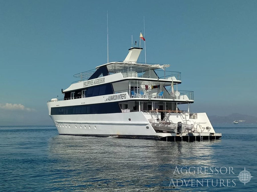
Philippines Aggressor
Tubbataha & Visayas Inseln (10 Nächte)
- Indicative duration
- 10 nights
- Einschiffung
- Puerto Princesa
- Ausschiffung
- Cebu
Philippines Aggressor
Visayas - Süd (7 nights)
- Indicative duration
- 7 nights
- Einschiffung
- Cebu
- Ausschiffung
- Dumaguete
Philippines Aggressor
Visayas - Süd (7 nights)
- Indicative duration
- 7 nights
- Einschiffung
- Dumaguete
- Ausschiffung
- Cebu
Philippines Aggressor
Visayas Inseln & Tubbataha (11 Nächte)
- Indicative duration
- 11 nights
- Einschiffung
- Cebu
- Ausschiffung
- Puerto Princesa
Philippines Aggressor
Visayas-Inseln (10 Nächte)
- Indicative duration
- 10 nights
- Einschiffung
- Cebu
- Ausschiffung
- Cebu
Philippines Aggressor
Visayas-Inseln (7 Nächte)
- Indicative duration
- 7 nights
- Einschiffung
- Cebu
- Ausschiffung
- Cebu
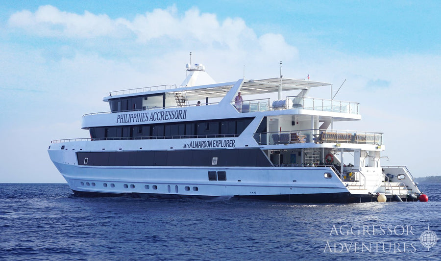
Philippines Aggressor II
Tubbataha & Visayas Inseln (10 Nächte)
- Indicative duration
- 10 nights
- Einschiffung
- Puerto Princesa
- Ausschiffung
- Cebu
Philippines Aggressor II
Visayas Inseln & Tubbataha (11 Nächte)
- Indicative duration
- 11 nights
- Einschiffung
- Cebu
- Ausschiffung
- Puerto Princesa
Philippines Aggressor II
Visayas-Inseln (10 Nächte)
- Indicative duration
- 10 nights
- Einschiffung
- Cebu
- Ausschiffung
- Cebu
Philippines Aggressor II
Visayas-Inseln (7 Nächte)
- Indicative duration
- 7 nights
- Einschiffung
- Cebu
- Ausschiffung
- Dumaguete
Philippines Aggressor II
Visayas-Inseln (7 Nächte)
- Indicative duration
- 7 nights
- Einschiffung
- Dumaguete
- Ausschiffung
- Cebu
Philippines Aggressor II
Visayas-Inseln (7 Nächte)
- Indicative duration
- 7 nights
- Einschiffung
- Cebu
- Ausschiffung
- Cebu
No routes match this search. Try another vessel or clear your search.
Wann sollte man auf den Visayas tauchen?
Auf den Visayas wird das ganze Jahr über getaucht, wobei sich viele Reiserouten auf die ruhigeren Monate von etwa November bis Mai konzentrieren. Einzelne Küsten und Überfahrten unterscheiden sich. Passen Sie die gewählte Route an ihre veröffentlichten Fahrpläne an und lassen Sie Spielraum für eine von den Bedingungen abhängige Reihenfolge der Tauchplätze.
Planungszeitraum: Wählen Sie die Daten für die Inseln auf Ihrer Route aus.
Was Sie beim Tauchen erwartet
Wählen Sie die Inseln und Tauchplätze entsprechend der Erfahrung der Gruppe aus.
Dauin und Apo Island
Das Makro-Tauchen im dunklen Sand von Dauin bildet einen Kontrast zu den Korallenriffen und dem Schildkrötenhabitat von Apo Island. Diese Kombination gibt Fotografen einen Grund, sowohl Makro- als auch Weitwinkelobjektive mitzuführen.
Die verschiedenen Küsten von Cebu
Moalboal bietet Sardinen und Wände, während Malapascua für Tauchgänge auf Fuchshaie bekannt ist. Sie liegen in verschiedenen Teilen von Cebu und benötigen jeweils eigene Reisezeiten oder eine Reiseroute, die sie ausdrücklich einschließt.
Bohol und die benachbarten Inseln
Panglao, Balicasag und Cabilao bieten unterschiedliche Kombinationen aus Wänden, Schildkröten, Korallengärten und Makro-Lebewesen. Ein Resort-Aufenthalt auf Bohol bietet zudem Raum für Ausflüge ins Hinterland.
Eine auf Ihre Interessen ausgewählte Route
Wählen Sie eine Kreuzfahrt anhand der Inseln und Tauchstile aus, die sie tatsächlich abdeckt. Eine auf Makro ausgerichtete Reise, eine Riff-Reiseroute und ein Offshore-Hai-Programm können alle als Visayas-Tauchen bezeichnet werden, bieten aber sehr unterschiedliche Urlaube.
DIVE SITE GUIDE
Dive sites in Visayas
These examples show the variety across the Visayas. They are not a single cruise itinerary: open each route to see which islands and dive areas it actually includes.
ORIENTATION MAP
Where the dive sites are
Use the map to understand how the key sites are spread around the destination. Pins are for trip-planning orientation only; entry points, moorings and the final dive plan are always confirmed by the local operator on the day.
Regional orientation only; the distance between islands matters when planning a journey.
Muck · Artificial reef · Macro
The Cars — Dauin & Apo Island
The Cars is one of Dauin’s most distinctive muck dives because the black-sand slope eventually leads to the remains of two vehicles and other artificial structure in the deeper part of the site.
Tauchplatz entdecken
- Typ
- Muck · Artificial reef · Macro
- Tiefe
- 5–30 m
- Erfahrung
- Open Water / Advanced for the cars
- Strömung
- Usually mild
The Cars is one of Dauin’s most distinctive muck dives because the black-sand slope eventually leads to the remains of two vehicles and other artificial structure in the deeper part of the site. The wreckage acts like a tiny oasis on an otherwise sparse seabed, attracting lionfish, morays, shrimp and a long list of smaller subjects.
The real pleasure is the approach: divers move slowly down the sand looking for frogfish, ghost pipefish, cuttlefish, seahorses and unusual nudibranchs before reaching the deeper structure. Open Water divers can enjoy the shallower macro zone, while the cars themselves sit beyond normal 18-metre limits and are better suited to Advanced divers, ideally with conservative gas and no-decompression planning.
Look for: Two sunken cars · Frogfish & ghost pipefish · Black-sand muck · Excellent photo dive
Ideal für: Macro photography · Frogfish · Ghost pipefish · Deep muck
Protected reef · Coral garden
Poblacion / Dauin Marine Sanctuary — Dauin & Apo Island
Poblacion shows the reef side of Dauin rather than its famous bare-sand muck habitat.
Tauchplatz entdecken
- Typ
- Protected reef · Coral garden
- Tiefe
- 3–25 m
- Erfahrung
- Beginner–Intermediate
- Strömung
- Mild–Moderate
Poblacion shows the reef side of Dauin rather than its famous bare-sand muck habitat. Inside the protected area, hard coral begins in very shallow water and slopes down toward roughly 25 metres, creating an easy place to combine reef fish, coral scenery and the possibility of turtles with a relaxed profile.
It is a useful first dive for guests arriving in Dauin because the shallow section allows buoyancy checks without sacrificing marine life, while photographers can move between wider coral scenes and smaller subjects tucked into the reef. The sanctuary can also work well for mixed-experience groups: newer divers stay on the upper slope, while more experienced divers can explore deeper sections without turning the dive into a demanding current or depth exercise.
Look for: Marine protected area · Hard-coral slope · Turtle potential · Good check dive
Ideal für: Healthy hard coral · Turtles · Easy reef diving
Offshore shoal · Shark cleaning station · Deep
Monad Shoal — Malapascua Island
Monad Shoal built Malapascua’s international reputation.
Tauchplatz entdecken
- Typ
- Offshore shoal · Shark cleaning station · Deep
- Tiefe
- 18–30+ m
- Erfahrung
- Advanced
- Strömung
- Variable
Monad Shoal built Malapascua’s international reputation. The submerged plateau sits beside a very deep drop-off and is used by pelagic thresher sharks visiting cleaning stations around the reef. The experience is usually less about swimming around the site and more about positioning carefully, staying calm and allowing the sharks to approach on their own terms.
Good buoyancy and disciplined depth control matter because useful viewing areas can be relatively deep, and Nitrox is often valuable for extending no-decompression time. Mantas, devil rays and other pelagics may also appear, but no sighting is guaranteed. The dive is at its best when treated as a patient wildlife observation rather than a chase for close photographs.
Look for: Thresher shark cleaning station · Deep offshore shoal · Pelagic potential · Advanced profile
Ideal für: Thresher sharks · Pelagic photography · Nitrox profiles
Pinnacle · Oceanic shoal · Pelagic
Kimud Shoal — Malapascua Island
Kimud Shoal is a deeper, more oceanic counterpart to Malapascua’s other shark dives.
Tauchplatz entdecken
- Typ
- Pinnacle · Oceanic shoal · Pelagic
- Tiefe
- 12–40 m
- Erfahrung
- Advanced
- Strömung
- Variable / can be strong
Kimud Shoal is a deeper, more oceanic counterpart to Malapascua’s other shark dives. The top of the submerged island begins around 12 metres before its sides fall into very deep water, creating the kind of edge where divers naturally watch both the reef and the blue.
Thresher sharks are now an important reason operators visit, while hammerheads, devil rays, eagle rays and tuna remain possible rather than guaranteed encounters. Because the useful part of the site may involve current, depth and open-water positioning, it is best for experienced divers who are comfortable following a strict group plan. A calm approach matters here too: the site rewards situational awareness and patience far more than aggressive pursuit of wildlife.
Look for: Oceanic shoal · Thresher shark potential · Hammerhead potential · Rays & tuna
Ideal für: Thresher sharks · Hammerhead potential · Rays · Blue-water diving
Slope · Wall · Drift
Black Forest, Balicasag — Bohol & Balicasag
Black Forest is one of Balicasag’s signature dives because the reef changes character as it descends.
Tauchplatz entdecken
- Typ
- Slope · Wall · Drift
- Tiefe
- 8–35 m
- Erfahrung
- Intermediate
- Strömung
- Mild–Moderate
Black Forest is one of Balicasag’s signature dives because the reef changes character as it descends. The upper slope is bright and fish-filled, while deeper sections are known for dark coral growth, larger fans and a more open-water feeling.
Turtles are frequent around the island and schools of jacks or barracuda may move through the blue when current is running. The best route follows the contour rather than forcing a fixed depth, letting the group spend time where fish activity is strongest. It is a very photogenic dive, but the deeper slope can tempt divers down, so good depth discipline is important even when the current feels easy.
Look for: Balicasag classic · Turtles · Schooling fish possible · Black-coral habitat
Ideal für: Turtles · Jacks · Black coral · Drift diving
Wall · Overhangs · Reef
Cathedral Wall, Balicasag — Bohol & Balicasag
Cathedral Wall is named for the way light enters cracks, fissures and overhangs in the reef face, creating shafts and shadowed spaces that give the wall a more architectural feel than a simple drop-off.
Tauchplatz entdecken
- Typ
- Wall · Overhangs · Reef
- Tiefe
- 5–30 m
- Erfahrung
- Intermediate
- Strömung
- Mild–Moderate
Cathedral Wall is named for the way light enters cracks, fissures and overhangs in the reef face, creating shafts and shadowed spaces that give the wall a more architectural feel than a simple drop-off. Divers can stay outside the openings and still get the full effect; there is no need to treat the site as an overhead-environment dive.
Turtles and reef fish are common around Balicasag, while fans, sponges and coral decorate the wall. The combination of vertical scenery and changing light makes this one of the island’s strongest wide-angle sites, especially when visibility is good and the group can move slowly along the face.
Look for: Wall topography · Light shafts · Turtles · Wide-angle photography
Ideal für: Wall scenery · Cavern-like light · Turtles · Wide angle
Shore dive · Reef wall · Schooling fish
Panagsama Sardine Run — Moalboal
The Panagsama Sardine Run is extraordinary because the headline experience begins only a short swim from shore.
Tauchplatz entdecken
- Typ
- Shore dive · Reef wall · Schooling fish
- Tiefe
- 3–18 m
- Erfahrung
- Beginner
- Strömung
- Usually mild
The Panagsama Sardine Run is extraordinary because the headline experience begins only a short swim from shore. A huge resident school holds near the reef drop-off, changing shape constantly as predators, divers and light move around it. The best dive is not to chase the school but to position beside it and let the sardines flow overhead, opening and closing into walls, funnels and tornado-like formations.
Green turtles are frequently seen along the same reef, while jacks and mackerel may hunt at the edge of the baitball. Because the action is shallow, bottom time can be long and even newer divers can experience it comfortably. The school’s exact position shifts, so guides locate it on the day rather than relying on one fixed marker.
Look for: Resident sardine school · Shore access · Turtles · Excellent wide angle
Ideal für: Sardine baitball · Turtles · Photography · Easy shore access
Wall · Reef · Cavern
Pescador Island — Moalboal
Pescador Island is Moalboal’s classic boat dive, a small offshore rock surrounded by steep reef and deep water.
Tauchplatz entdecken
- Typ
- Wall · Reef · Cavern
- Tiefe
- 7–30+ m
- Erfahrung
- Intermediate
- Strömung
- Variable
Pescador Island is Moalboal’s classic boat dive, a small offshore rock surrounded by steep reef and deep water. The north and west sides drop into dramatic walls, while the southern side offers a gentler slope. The famous Cathedral area adds cavern-like topography and shafts of light, and the reef itself carries hard coral, smaller macro subjects and schooling fish.
Divers may see barracuda, tuna and the occasional reef shark, but the site is worth diving even without pelagics because the wall and coral structure are so strong. Current can range from almost still to a fast drift, so the operator normally chooses the entry point according to tide and group experience. It is the natural place to use a wide-angle lens in Moalboal.
Look for: Iconic island wall · Cathedral topography · Coral & schooling fish · Current-dependent
Ideal für: Wall diving · Cathedral cavern · Reef fish · Wide angle
Unterwasserfotografie
Planen Sie die Kameraausrüstung anhand der tatsächlichen Inseln auf Ihrer Reiseroute. Makro-Fotografie in Dauin, die Sardinen von Moalboal und ein Hai-Tauchgang bei Malapascua erfordern unterschiedliche Ansätze. Bereiten Sie sich auf einer Kreuzfahrt auf die für den nächsten Tag angekündigten Tauchplätze vor; bei einer Resort-Reise wiederholen Sie einen produktiven Tauchplatz, wenn Sie Zeit haben, ein bestimmtes Bild zu verbessern.
Abseits des Tauchens: Die Visayas oberhalb der Wasseroberfläche
Die weitere Region bietet genügend Vielfalt an Land für einen Urlaub, bei dem es nicht ausschließlich um das Tauchen geht. Das Hinterland von Bohol, die Wasserfälle von Siquijor, die Landschaft im Landesinneren von Cebu und das Küstenleben rund um Dumaguete bereichern die Reise jeweils auf unterschiedliche Weise.
Dies sind separate Inseln, zwischen denen echte Reisezeiten liegen. Wählen Sie zwei oder drei sich ergänzende Standorte, anstatt zu versuchen, jeden Ortsnamen abzuhaken. Die Route eines Liveaboards ist ebenfalls eine Auswahl der Region und keine Zusage, alle in diesem Leitfaden gezeigten Ziele zu besuchen.
Anreise zu den Visayas
Cebu ist ein häufiger Ausgangspunkt für Reisen zu den Visayas, aber einzelne Kreuzfahrten und Inselaufenthalte können unterschiedliche Häfen und Flughäfen nutzen. Dumaguete und Bohol können für bestimmte Resort-Programme nützlich sein. Planen Sie die Reise immer anhand der ausgewählten Inseln und nicht anhand einer allgemeinen regionalen Bezeichnung.
Inselübergänge dauern Zeit. Einige gut gewählte Standorte machen in der Regel einen angenehmeren Urlaub als der tägliche Inselwechsel, und eine Kreuzfahrtroute kann eine praktische Möglichkeit sein, Orte zu verbinden, wenn ihre Ein- und Ausstieghäfen zur weiteren Reise passen.
Fragen zum Tauchen auf den Visayas
Besucht jede Visayas-Route alle diese Inseln?
Ein Liveaboard kann ausgewählte Teile der Region verbinden, ohne dass häufig der Hotelwechsel erforderlich ist; eine Resort-Reiseroute ermöglicht es Ihnen, länger an den Orten zu verbringen, die Sie am meisten interessieren. Lesen Sie die tatsächliche Route sorgfältig durch. Eine Visayas-Kreuzfahrt kann nur Teile von Cebu, Bohol, Negros, Leyte oder den benachbarten Inseln erkunden und sollte nicht davon ausgegangen werden, dass sie alle hier aufgeführten Ziele besucht.
Wie sollte ich meinen Aufenthalt planen?
Wählen Sie ein Liveaboard anhand der tatsächlich besuchten Inseln sowie der Häfen für den Ein- und Ausstieg. Eine Resort-Kombination ist besser, wenn Sie mehr Zeit an Land oder wiederholte Tauchgänge vor Ort wünschen. Sieben bis zwölf Nächte bieten einen guten Rahmen für eine Kreuzfahrt oder einen sorgfältig getakteten Aufenthalt an zwei Standorten.
Wann ist eine gute Reisezeit?
Auf den Visayas wird das ganze Jahr über getaucht, wobei sich viele Reiserouten auf die ruhigeren Monate von etwa November bis Mai konzentrieren. Einzelne Küsten und Überfahrten unterscheiden sich. Passen Sie die gewählte Route an ihre veröffentlichten Fahrpläne an und lassen Sie Spielraum für eine von den Bedingungen abhängige Reihenfolge der Tauchplätze.
Gibt es genug für nicht-tauchende Begleiter?
Die weitere Region bietet genügend Vielfalt an Land für einen Urlaub, bei dem es nicht ausschließlich um das Tauchen geht. Das Hinterland von Bohol, die Wasserfälle von Siquijor, die Landschaft im Landesinneren von Cebu und das Küstenleben rund um Dumaguete bereichern die Reise jeweils auf unterschiedliche Weise.
A closer look at Visayas


Planen Sie Ihre Visayas-Reise
Teilen Sie uns mit, welche Erlebnisse Sie am meisten wünschen, welche Daten Sie bevorzugen und wie Sie reisen möchten. Wir können das Reiseziel, die Unterkunft und das Tauchen in einer stimmigen Reiseroute zusammenbringen.
Meine Reise planenFoto-Credits
Die Bilder werden für die Anzeige skaliert und können zugeschnitten werden, um in das Seitenlayout zu passen.
- Dichte Sardinenschwarm bei Moalboal, Cebu, auf den Visayas: 2014 11 Moalboal 21 sardine run (16024303526).jpg — Lakshmi Sawitri. CC BY 2.0. Web-Größenbild von Wikimedia Commons bereitgestellt; keine Bildbearbeitung.
- Streifenkoboldhai, fotografiert vor der Insel Malapascua, Philippinen: Tresher1.jpg — James Heilman, MD. CC BY-SA 4.0. Web-Größenbild von Wikimedia Commons bereitgestellt; keine Bildbearbeitung.
- Gelbe Riffkugelfische und verzweigte Korallen auf der Insel Balicasag, Bohol: Balicasag Reef.jpg — Thomas Brown. CC BY 2.0. Web-Größenbild von Wikimedia Commons bereitgestellt; keine Bildbearbeitung.
- Luftaufnahme der Insel Pescador vor Moalboal, Cebu: Pescador Island (Unsplash).jpg — Ken Suarez kensuarez. CC0. Web-Größenbild von Wikimedia Commons bereitgestellt; keine Bildbearbeitung.
- Meeresschildkröte, die sich zwischen Korallen auf der Insel Apo, Negros ausruht: Sleepy Turtle in Apo Island.jpg — Anna Varona. CC BY 4.0. Web-Größenbild von Wikimedia Commons bereitgestellt; keine Bildbearbeitung.
- Apo Island, gesehen vom Meer aus vor Negros Oriental: Apo Island east.jpg — Mike Gonzalez (TheCoffee). CC BY-SA 3.0. Web-Größenbild von Wikimedia Commons bereitgestellt; keine Bildbearbeitung.
- Ansammlung von durchscheinenden Seescheiden, fotografiert auf der Insel Apo: Tunicates (6851439624).jpg — Elias Levy. CC BY 2.0. Web-Größenbild von Wikimedia Commons bereitgestellt; keine Bildbearbeitung.
- Bootssilhouette gegen den Sonnenuntergang in San Juan, Siquijor: San Juan, Siquijor.jpg — Jerche Amada. CC BY-SA 4.0. Web-Größenbild von Wikimedia Commons bereitgestellt; keine Bildbearbeitung.


